Florida is preparing for one of the strongest hurricanes of the season (Hurricane Helene). A rapidly developing storm in the Caribbean Sea could bring devastating storm surges and hurricane-force winds to the Southeastern United States.
Hurricane Helene Expected to Intensify
The National Hurricane Center reports that the system will soon intensify into Hurricane Helene. The storm is expected to strike the Gulf Coast, particularly Florida, later this week. As of now, it has been named Potential Tropical Cyclone Nine.
According to meteorologists, Helene will accelerate quickly, building wind and rain across the Southeastern states. As the storm approaches, it will likely make landfall in Florida. The National Hurricane Center has issued hurricane watches for Florida’s Gulf Coast, stretching from Englewood to Indian Pass including Tampa Bay and Charlotte Harbor.
Warnings in Effect for Gulf Coast Areas
A tropical storm watch has also been issued from Bonita Beach to Englewood and up to the Walton-Bay County line. Additionally, the Florida Keys and Dry Tortugas are under tropical storm warnings. With the storm expected to gain strength, Governor Ron DeSantis has declared a state of emergency in 41 counties. This move will help speed up emergency preparations and ensure coordination between local and state agencies.
Preparing for the Worst: Tampa General Hospital Takes Action
Despite limited time, local authorities and institutions are making swift preparations. Tampa General Hospital erected a 10-foot-high flood barrier on Monday. They are taking precautions due to potential storm surges that could affect their facilities. Meteorologists expect Hurricane Helene to intensify into a Category 3 storm by Wednesday night. The hurricane could reach Florida by the end of the week, bringing life-threatening winds and rainfall.
A Look at Florida’s History with Hurricanes
Florida is no stranger to severe hurricanes. Last year, Hurricane Idalia made landfall as a Category 3 storm, with winds of 125 mph. The storm caused record-breaking storm surges across Tampa and Florida’s Big Bend area. Experts believe that Hurricane Helene could follow a similar pattern. The warm waters in the Gulf of Mexico could enable rapid intensification, increasing wind speeds by up to 55 mph within 24 hours.
Where Helene Could Make Landfall
Currently, projections show that Hurricane Helene could hit Florida’s Big Bend region. However, meteorologists warn that areas from Florida’s Gulf Coast to Louisiana should remain vigilant. High winds and dangerous storm surges are expected near the landfall zone, potentially causing widespread damage.
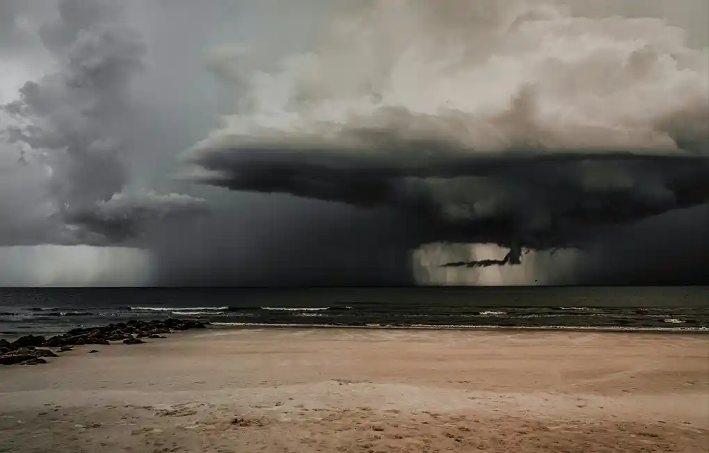
The storm will also create rough seas across the Gulf of Mexico, with large waves and hazardous rip currents. These dangerous conditions will likely impact the entire Gulf region later this week.
Hurricane Helene’s Rapid Intensification
The National Hurricane Center has predicted that Hurricane Helene will undergo rapid intensification as it moves through the Gulf. The storm is forecast to become a hurricane by Wednesday, with further strengthening likely by Thursday. Forecasting the storm’s exact path remains challenging until the system becomes fully organized.
This storm will bring torrential rains to Mexico, Cuba, Jamaica, and parts of Central America. The rainfall could lead to life-threatening floods and mudslides in some areas. The ”National Hurricane Center” had already issued warnings for the tropical storm for the above mentioned regions.
Potential Impact on the Southeastern United States
The record-breaking warmth of the Gulf’s waters will significantly increase the storm’s power. As a result, impacts from Hurricane Helene will extend well beyond its center. This means that areas far inland could experience gusty winds and heavy rainfall, leading to widespread flooding and power outages.
Beginning midweek, heavy rain is likely to affect much of the Southeastern U.S., including Georgia, Alabama, and parts of the ”Carolinas”. The Weather Prediction Center has placed these areas at a level 2 of 4 risk for flooding. As the storm moves across Florida, it could bring flash floods and widespread urban flooding.
Florida’s Vulnerability to Storm Surges
Experts warn that Florida, especially its west coast, is highly vulnerable to storm surges. Cities like Tampa Bay are particularly at risk due to their geography. High winds and low pressure from ”Hurricane Helene” will likely push significant amounts of seawater inland, causing dangerous surges.
The hurricane’s rapid intensification is particularly concerning. Most major hurricanes, including Hurricane Ian in 2022 and Hurricane Michael in 2018, experienced similar explosive growth. These storms gained power from the warm waters in the Gulf, rapidly increasing their wind speeds within hours.
Understanding Rapid Intensification
Rapid intensification occurs when a storm’s wind speeds increase dramatically over a short period, typically 24 hours. In technical terms, this means a wind speed increase of at least 35 mph. However, storms can intensify even more, depending on the conditions. Warm water and ample moisture fuel these storms, allowing them to grow more powerful.
The Gulf of Mexico’s current water temperature is at a record high for this time of year. This factor, combined with low wind shear, will enable Hurricane Helene to intensify rapidly. Wind shear typically prevents a hurricane from growing stronger by disrupting its high cloud formations. However, forecasters believe that Helene will encounter minimal wind shear, allowing it to strengthen freely.
The Dangers of Rapid Intensification
Rapidly intensifying storms pose unique challenges for both residents and forecasters. These storms leave little time for accurate predictions and evacuations. In many cases, residents go to bed expecting a minor storm, only to wake up facing a dangerous hurricane. Such was the case with Hurricane Otis, which shocked residents in Acapulco, Mexico, after its wind speeds increased by 110 mph within a single day.
Higher wind speeds, coupled with lower barometric pressure, can result in devastating storm surges and structural damage. This is especially true in regions like ”Florida”, where the shallow continental shelf heightens storm surge risks.
Forecasters’ Improving Abilities
While forecasting rapid intensification remains a challenge, recent technological advancements have improved predictions. Hurricane hunters, drones, and other tools now provide real-time data to forecasters, helping them track a storm’s development more accurately. In fact, the National Hurricane Center has made significant progress in predicting rapid intensification over the last decade.
However, many storms, such as Beryl and Otis, still surprise meteorologists with their intensity. The rise in rapid intensification events has led scientists to believe that climate change is playing a role. NOAA scientists suggest that while the long-term effects of warming temperatures on hurricanes remain uncertain, rapid intensification is becoming more common.
Conclusion
As Hurricane Helene strengthens in the Gulf of Mexico, Florida and the Southeastern U.S. must prepare for severe impacts. Rapid intensification, dangerous storm surges, and flooding are all likely outcomes. As forecasters continue to monitor the storm’s path, residents in affected areas should stay updated and take necessary precautions.