

Bisbee Is More Than a Town, It Is a Trail head
Most people come to Bisbee for the mine tour. The ghost tour. The galleries and restaurants.
They do not come expecting a serious outdoor destination.
That is a mistake worth correcting.
Bisbee sits at 5,300 feet elevation in the heart of the Mule Mountains, a rugged, biologically diverse range in the Sky Islands of southeastern Arizona. The trails here wind through an extraordinarily rare ecosystem where cholla cactus and fir trees coexist, hummingbirds of 14 species pass through on migration routes, and the canyon walls above Old Bisbee reveal geological formations visible nowhere else on earth.
Add to this the town’s 1,000 staircase steps, the most famous urban stair climb in Arizona, and hiking in Bisbee AZ becomes as compelling as everything else the town offers.
This guide covers every trail worth your time, from the Bisbee 1000 urban stair route to the summit of Mt. Ballard, the highest point in the Mule Mountains. For the complete Bisbee experience before and after your hike, see our guide to the best things to do in Bisbee AZ.
Table of Contents
What Makes Bisbee a Unique Hiking Destination
Bisbee’s hiking scene is unlike any other small town in Arizona for three reasons.
The urban-to-wilderness transition is immediate. You can walk out of the Copper Queen Hotel, turn up a staircase, and be on a mountain trail within 20 minutes. No driving, no trailhead parking lot, no shuttle. The town and the wilderness are continuous.
The biodiversity is extraordinary. The Mule Mountains sit in the Sky Islands, isolated mountain ranges that rise dramatically from desert basins and act as ecological bridges between North American and Mexican wildlife zones. On a single hike you can encounter species normally found in different climate zones entirely.
The views are dramatic. Bisbee sits in a narrow canyon. Every trail that climbs out of it rewards you with a panoramic view of the canyon below, the Lavender Pit, and on clear days, four separate mountain ranges stretching to the horizon.
Best Hiking Trails in Bisbee AZ
1. Bisbee 1000 (The Great Stair Climb) Most Iconic
Distance: 4.5 miles | Elevation Gain: ~1,000 feet Difficulty: Moderate | AllTrails Rating: 4.6 stars (1,089 reviews) Best For: All fitness levels, photography, experiencing Bisbee’s architecture
The Bisbee 1000 is not a traditional hiking trail. It is a 4.5-mile urban route that connects nine of Bisbee’s public staircases, totaling more than 1,000 steps, winding through the town’s historic neighborhoods, canyon streets, and hillside communities.
Every October, hundreds of runners complete this route in a timed race. But you do not need to run it. Walking the Bisbee 1000 at a comfortable pace takes about 90 minutes and is one of the most visually rewarding experiences in Arizona.
At every turn: murals on canyon walls, Victorian cottages built into the rock, art installations tucked into staircase landings, and increasingly dramatic views over the canyon floor as you climb.
The route passes through:
- The historic Copper Queen Hotel area
- The Youngblood Hill neighborhood
- The OK Street corridor
- The Grassy Steps
- Multiple canyon overlooks
Tip: Pick up a Bisbee 1000 map at the Bisbee Visitor Center (2 Copper Queen Plaza) or download the route on AllTrails before you start. The route is not always obvious at intersections.
Best time: Early morning on weekdays for solitude. Avoid midday in July and August.
2. Chihuahua Hill / B Mountain Trail, Best for Quick Views
Distance: ~1.5 miles round trip | Elevation Gain: ~400 feet Difficulty: Easy–Moderate | Best For: First-time hikers, quick panoramic views
The Chihuahua Hill trail leads up toward the large white “B” painted on the mountainside above Bisbee, a well-known landmark visible from most of the historic district.
The trail climbs steadily through desert vegetation typical of the Mule Mountains: yuccas, agaves, various cacti, and scattered desert shrubs. The summit area offers one of the best panoramic views of Old Bisbee and the surrounding canyon available from any trail this short.
Desert cottontails and a remarkable variety of birds are common sightings along this route. In spring, wildflower blooms along the trail add significant color.
Tip: The trail begins on the north side of Old Bisbee. It is steep in places but manageable for any reasonably fit adult. Total time: 45–60 minutes round trip.
3. North Tombstone Canyon Trail, Best Scenic Hike from Town
Distance: ~3.7 miles (loop) | Elevation Gain: ~469 feet Difficulty: Moderate | Best For: Scenic hiking, mix of urban and wilderness
This loop trail winds through Old Bisbee before climbing steadily into the surrounding Mule Mountains. It is a mix of urban walking and proper trail hiking, you pass through the historic neighborhood before the trail transitions into open mountain terrain.
The views from the upper sections of the loop look back down into Tombstone Canyon and the historic district below with a perspective that photographs can rarely capture adequately. The trail is 3.7 miles with 469 feet of total elevation gain, a manageable afternoon hike for most visitors.
Some sections are quite narrow with little shade coverage. Bring water and start before 9 AM in summer months.
4. Old Bisbee and Juniper Flats Loop, Best for Solitude
Distance: ~4–5 miles | Elevation Gain: ~800 feet Difficulty: Moderate | Best For: Experienced hikers, high desert ecology, solitude
The Old Bisbee and Juniper Flats trail offers a journey into a high desert landscape that most visitors to Bisbee never see. Once the trail leaves the town behind, it enters a genuinely wild stretch of Mule Mountains terrain.
The Juniper Flats section moves through an open plateau of pinyon pine, juniper, and high desert scrub with wide sky and long views. Wildlife encounters are common, the Mule Mountains support an unusually diverse bird population due to their Sky Island ecology.
This trail is unlikely to encounter many other people. If solitude is what you want after a busy Saturday in town, this is your trail.
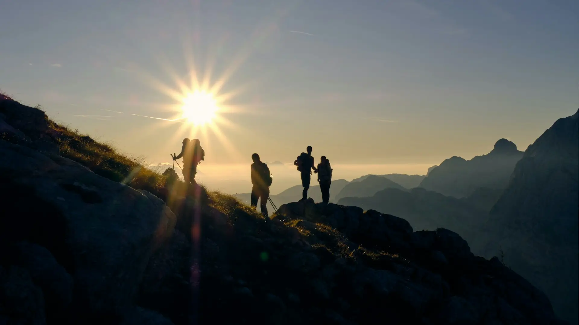
5. Fissure Peak and Mount Ballard via Mule Pass, Best Summit Experience
Distance: 4.1 miles out-and-back | Elevation Gain: 1,696 feet Difficulty: Hard | AllTrails Rating: 4.7 stars Best For: Experienced hikers, peak baggers, four-mountain-range views
Mount Ballard at 7,379 feet is the highest point in the Mule Mountains and the most rewarding summit in the Bisbee area. The Fissure Peak and Mount Ballard via Mule Pass trail covers 4.1 miles with 1,696 feet of elevation gain, challenging but achievable for fit hikers in good conditions.
The summit rewards are exceptional. On a clear day, four separate mountain ranges are visible from the top, a panorama that puts all of southeastern Arizona’s Sky Island geography into sudden, dramatic perspective.
The trail passes through a remarkable ecological transition, from desert scrub at the base to pinyon-juniper woodland at mid-elevation to oak and fir near the summit. It is the rare Arizona hike that feels genuinely alpine in its upper sections.
Tip: Park near the white stone wall at the Mule Pass trailhead. Stay on marked paths, reviewers consistently note that straying from the route leads to brushy, difficult terrain. The best times to hike this trail are January through May.
Average completion time: 2 hours 57 minutes.
6. Brewery Gulch Mining Roads, Best for History and Discovery
Difficulty: Easy | Best For: Casual walkers, mining history, hidden paths
The old mining roads above Brewery Gulch offer a different kind of Bisbee hiking, quiet, flat, historically rich, and almost entirely off the tourist radar.
These roads were the working arteries of Bisbee’s mining operations, connecting shafts and processing facilities across the canyon walls above the gulch. Today they are open paths that let you walk quietly through the industrial archaeology of the mining era while looking back down into the town below.
No trailhead sign. No AllTrails listing. Ask at the Bisbee Visitor Center for directions to the upper Brewery Gulch road access.
Best for: Visitors who want to explore away from the crowds and connect with the quieter, more contemplative side of Bisbee’s history.
Guided Hikes in Bisbee AZ
If you prefer guided hiking, B Active Bisbee (bactivebisbee.com) is the only tour operator in town offering structured hiking experiences led by expert local guides.
The “High” Trail A 2.5-hour guided hike on the Ridge Trail with 800–1,000 feet of elevation gain and privileged views over Bisbee and the surrounding ranges. Best for experienced hikers.
The “Spring” Trek A 3–3.5 hour guided summit hike to Mt. Ballard (3.5 miles, 1,350 feet elevation gain). The most challenging guided hike available, and the most rewarding. Your guide explains the rare ecology of the Sky Islands along the route.
Both tours meet at the B Active Bisbee store. Book in advance as group sizes are limited.
The Annual Bisbee 1000 Stair Climb Race
Every October, Bisbee hosts the Bisbee 1000, Arizona’s most distinctive urban race event.
The 4.5-mile course covers all nine of Bisbee’s public staircases, totaling more than 1,000 steps through the historic canyon neighborhoods. Hundreds of participants run, walk, or crawl the course in a timed event that has become one of the most beloved community events in southern Arizona.
Race categories: Competitive runners, casual walkers, and even a dog-friendly division. The course is open to all fitness levels, many participants walk the entire route.
The atmosphere is festive. Bisbee residents line the staircases, cheering participants and playing music at staircase landings. The event captures Bisbee’s community spirit more fully than almost anything else on the calendar.
Registration: Opens several months in advance at bisbee1000.org. The event sells out. If you want to race, register early.
Can’t make race day? The course is open for self-guided walking year-round. Download the route at AllTrails (search “Bisbee 1000 The Great Stair Climb”) and walk it any morning you are in town.
Practical Tips for Hiking in Bisbee AZ
Start early. Bisbee sits in a south-facing canyon that heats up quickly. For any trail over 2 miles, start before 8 AM in summer. Spring and fall hikes can start later.
Bring water. The standard advice: carry at least 2 liters per person for any trail over 2 miles. Dehydration happens faster at altitude than most visitors expect.
Wear proper footwear. The Bisbee 1000 staircases can be managed in good sneakers. Any trail beyond town requires hiking boots or shoes with solid grip and ankle support, the terrain is rocky and uneven.
Watch for afternoon monsoons in summer. July and August bring afternoon thunderstorms, typically from 2–5 PM. Start hikes early and be off exposed ridges before noon.
Wildlife awareness. The Mule Mountains support rattlesnakes, desert cottontails, coatimundis, and a remarkable diversity of birds including 14 hummingbird species. Keep a safe distance from wildlife and stay on marked trails.
Pets on trails. Pets are generally allowed if leashed. Bring extra water for dogs and be cautious of heat and wildlife. Some steep staircase sections can be difficult for dogs.
FAQs: Hiking in Bisbee AZ
What is the Bisbee 1000?
The Bisbee 1000 is a 4.5-mile urban route and annual race covering nine of Bisbee’s public staircases, totaling more than 1,000 steps through the historic canyon neighborhoods. It is Bisbee’s most famous walking/running experience and is open for self-guided exploration year-round.
What are the best hiking trails in Bisbee AZ?
The Bisbee 1000 (urban, iconic, all levels), Chihuahua Hill/B Mountain (short, great views), North Tombstone Canyon Loop (moderate, scenic), and Fissure Peak/Mt. Ballard (challenging, summit views of four mountain ranges) are the four most recommended trails.
How difficult is hiking in Bisbee?
Trails range from easy (Brewery Gulch roads, B Mountain) to moderate (Bisbee 1000, North Tombstone Canyon) to hard (Mt. Ballard). The Bisbee 1000 stair climb is accessible to most reasonably fit adults.
When is the best time to hike in Bisbee AZ?
January through May is ideal. Fall (September–November) is also excellent. Summer hiking is possible early morning before 9 AM. Avoid midday hiking in July and August.
Are there guided hikes in Bisbee AZ?
Yes, B Active Bisbee (bactivebisbee.com) offers guided hikes including the “High” Trail (ridge views, 800–1,000 ft gain) and the “Spring” Trek (Mt. Ballard summit, 1,350 ft gain), both led by expert local guides.
Hiked a trail in Bisbee that deserves to be on this list? Drop it in the comments.
Quick Reference: Hiking Trails in Bisbee AZ
| Trail | Distance | Difficulty | Best For |
|---|---|---|---|
| Bisbee 1000 Stair Climb | 4.5 miles | Moderate | Urban, photography, iconic |
| Chihuahua Hill / B Mountain | ~1.5 mi RT | Easy–Moderate | Quick views, first-timers |
| North Tombstone Canyon Loop | 3.7 miles | Moderate | Scenic, mixed urban/trail |
| Old Bisbee & Juniper Flats | ~4–5 miles | Moderate | Solitude, ecology |
| Fissure Peak / Mt. Ballard | 4.1 mi RT | Hard | Summit, 4-range views |
| Brewery Gulch Mining Roads | Varies | Easy | History, discovery, quiet |

")
")